City Park / Museum
Route 48. This is your car.
It turns right up North Carrollton and ends at Esplanade by the gates of City Park, a 6-minute walk from the art museum.
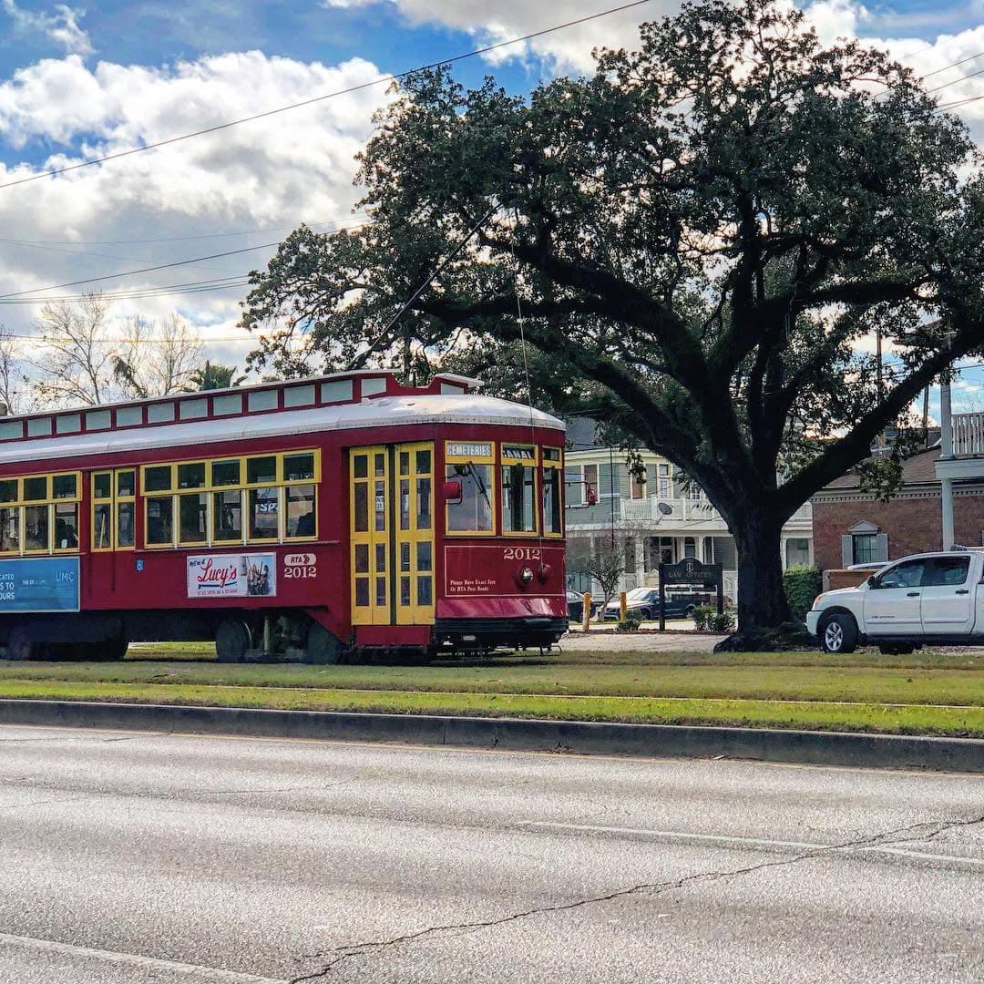
New Orleans · the red streetcar, end to end
A dollar and a quarter, half an hour or so on a wooden seat, and one sign to read. Ride the red Canal streetcar out of the French Quarter to the Mid-City that New Orleanians keep for themselves: Creole-Italian dining rooms, Sicilian ices, snoball stands, the art museum under the oaks, and a long, shaded walk home down Esplanade.
Step onto the red car at Canal and Bourbon and the Quarter falls away in a few blocks. The bells clang, the trolley pole hums on the wire overhead, and the car rocks up the middle of Canal Street on a strip of grass the whole city calls the neutral ground. Past Broad the buildings drop to porches and shotgun houses, and the riders change from visitors with go-cups to nurses, schoolkids and grandmothers with grocery bags. Twenty-odd stops later the car swings up North Carrollton, past a family ice-cream parlor whose Sicilian lemon ice goes back to the early 1900s, and stops under the live oaks at the gates of City Park.
This guide is for anyone who has done Bourbon and Jackson Square and wondered what the rest of New Orleans is like. It's for anyone who would like a little nudge to go and find out. The red car is the easiest way out: no transfers, no driving, $1.25, and air-conditioning. The places on these pages are the ones locals actually use. They're a block or two off the line, mostly a few minutes' walk from a stop, and every walk is timed in minutes so you never have to guess.
Mid-City is a working, residential neighborhood that, outside Jazz Fest, visitors largely leave alone. That's the pleasure of it. You'll be one of the few out-of-towners at the counter, and people will be glad to tell you what to order.
The honest partWikivoyage describes Mid-City as generally safe by day, with conditions that can change block by block. It advises skipping the stretch east of Broad off the line and much of Tulane Avenue, and calls the area near City Park and west of North Carrollton generally very safe. The plan here keeps you on or near the streetcar, in daylight, with an easy ride home. That's exactly how locals use it.
Fares and hours: New Orleans & Company, RTA, NOMA. Check the RTA service alerts before you go; track work has bused parts of the Canal line in 2026.
The whole line runs up Canal together, then forks at Carrollton Avenue. Two kinds of red car share the tracks and they alternate, so the black roll sign above the front window is the one thing a first-timer has to get right. If the wrong one pulls up, let it go. Another is coming.
It turns right up North Carrollton and ends at Esplanade by the gates of City Park, a 6-minute walk from the art museum.
It stays on Canal to the end, among the old cemeteries. It's a great half-day on its own (see the end of this guide). If you're already on one, step off at Canal at Carrollton and wait for a City Park car.
Don't do this on a Monday. NOMA, Angelo Brocato and Cafe Degas are all closed, and so is the Botanical Garden. Tuesday through Saturday is the sweet spot. Wednesday is a bonus, with NOMA open late until 7, Pitot House tours running, and the Landmarks Society's bayou walk at 1 p.m. Sunday works for the park, but Liuzza's is closed (except during Saints games) and the Botanical Garden shuts at 4:30.
The ride itself is cool, but the walks are not. From the end of the line, NOMA is 6 minutes on foot, the Esplanade restaurants 8–11, and the Botanical Garden 11. That's nothing in March and a slog in August. Late October through April is the comfortable window. In summer, ride out early, do the outdoor stretches before about 10 a.m. or after 4, and spend the middle of the day in NOMA's galleries or the Botanical Garden's conservatory. The oak shade is real in the park and on Esplanade. The open banks of Bayou St. John and the bare marble of the cemeteries have almost none. Carry water. Hurricane season runs June 1 – November 30.
Approximate NOAA 1991–2020 normals for New Orleans; humidity runs high all year.
The guide's stops are in gold. The Cemeteries branch splits off at Carrollton. Stop names are from OpenStreetMap's Route 48 data.
Out here the food is the everyday kind, and it tells the city's other story. Sicilian immigrants shaped New Orleans' table as much as the French and Spanish did, and Mid-City keeps that alive in two places: a Creole-Italian dining room run by the same family since 1932, and an ice-cream parlor built on Palermo technique. Around them sit gas-station po-boy counters, a walk-up snoball stand that's been scooping since 1970, and a French bistro on Esplanade with a covered, open-air dining room. Treat dessert as its own trip, the way locals do.
| Order this | What it is · where |
|---|---|
| Trout almandine & shrimp remoulade | Mandina's signatures: pan-fried trout under toasted almonds and brown butter, and Gulf shrimp in a tangy Creole remoulade. Round it out with red gravy and meatballs or a fried seafood platter. Mandina's |
| Lemon ice & cannoli | Granita al limone the Palermo way, cannoli and torroncino, the very first flavor Angelo Brocato sold. Brocato's |
| Stuffed snoball | A fluffy snoball built around a core of house-made ice cream. Pandora's |
| Hot sausage po-boy | The city's sandwich on French bread, from a gas-station counter. Banks Meat Market · or a classic at Parkway |
| BBQ shrimp po-boy | Shrimp in peppery butter (no barbecue sauce) on French bread. Liuzza's by the Track |
| Paella | Cooked from scratch to order, so allow 30–60 minutes and order a pitcher of sangria. Lola's |
| Onion soup, mussels | French bistro classics on Esplanade. Cafe Degas |
| Beignets | Powdered-sugar squares and café au lait under the park's oaks, with no Quarter queue. Cafe Du Monde City Park |
| Red beans (Mon) | Monday is red-beans-and-rice day all over town, and the one good thing about doing this on a Monday. |
| When | How locals eat out here |
|---|---|
| 7–10 a.m. | Breakfast is quick on weekdays: grits, eggs, biscuits. Up & Adam on Canal. |
| 11:30–2 | Lunch is the main meal for many: po-boys, plate lunches, boiled seafood. Kitchens out here close earlier than you'd expect. |
| Noon–6 | The afternoon snoball on a warm day, in line at a walk-up window. |
| 3–6 p.m. | Happy hour at neighborhood bars, plus pâté-and-cheese hour at Cafe Degas (Wed–Sat 3–5). |
| 6–9 p.m. | Dinner starts earlier at family places, and Liuzza's stops at 8. Weekends fill up. |
| After dinner | The dessert run: a drive or walk over to Brocato's, open until 10 most nights. |
When to go
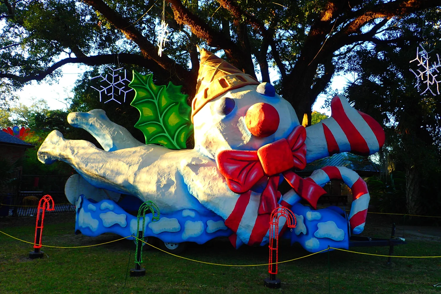
Celebration in the Oaks · Nov 27, 2026 – Jan 1, 2027. Every holiday season City Park strings its live-oak groves with lights. It's a New Orleans family tradition that began in the late 1980s, and the park's own listing puts attendance at more than 135,000 visitors. Visitors without a car do the walking tour. It takes about 90 minutes and includes the Botanical Garden and Carousel Gardens, the amusement park with the historic carousel locals call the Flying Horses. Look for Mr. Bingle, the city's beloved snowman puppet, among the displays.
TicketsSold online only from Nov 1; no gate sales, and the event is cashless. Walking tour $35 ($25 with a driving ticket), $20 on Value Nights, free for children 2 and under. Hours: Mon–Thu 6–10 p.m., Fri–Sat 5–10, Sun 5–9. Weekends and Value Nights sell out first. The walking-tour entrance at 7 Victory Ave is an 11–15 minute walk from the end of the line. Book an Uber home rather than gamble on the last car.
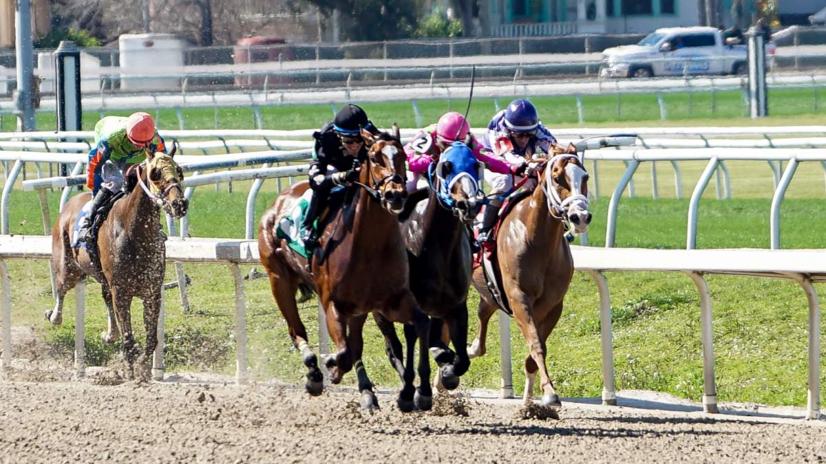
Nov 19, 2026 – Mar 21, 2027
The third-oldest thoroughbred track in the country is a winter-afternoon ritual a short ride down Esplanade. The Thanksgiving Day card (Nov 26, noon) is a local tradition, and Louisiana Derby Day is Mar 20.
Sun Nov 1 – Mon Nov 2, 2026
Families tend and decorate the tombs. St. Louis Cemetery No. 3 admits no tours or tourists on these two days, so plan it for another day that week. Greenwood isn't Archdiocese-run; call ahead.
Sat Feb 6, 2027 · Mardi Gras Tue Feb 9
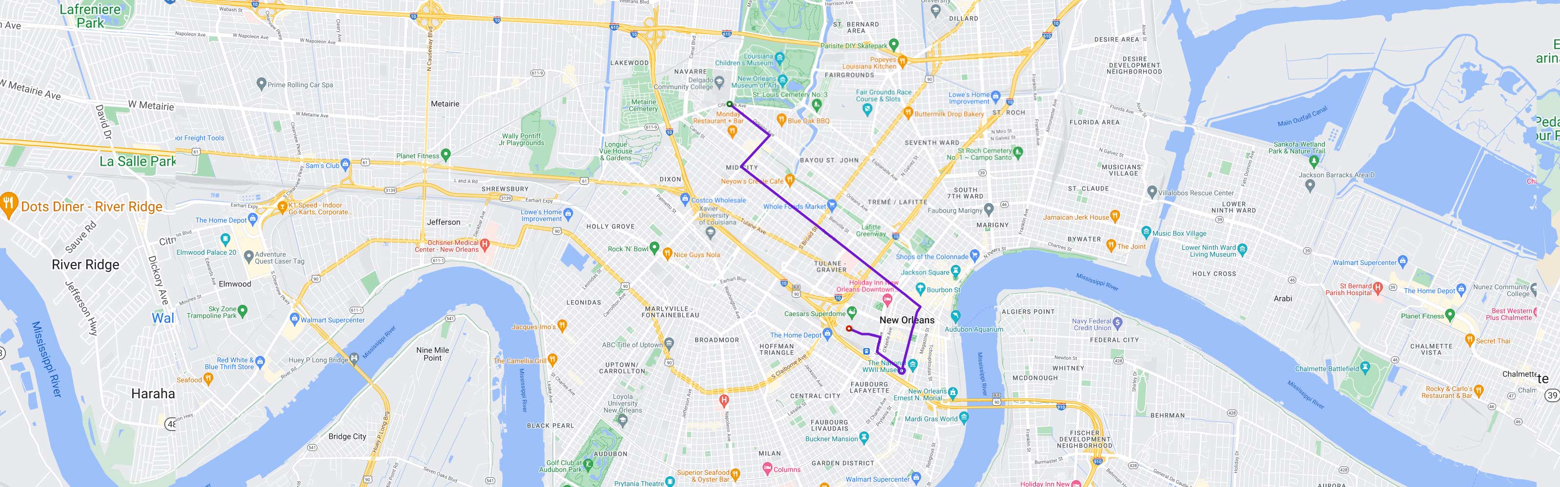
One of Carnival's biggest parades starts at City Park Ave and Orleans Ave, rolls down North Carrollton and turns onto Canal, right along the streetcar. Join the Mid-City crowd on purpose or come another day. NOMA and the garden close on Endymion Saturday, Lundi Gras and Mardi Gras, and streetcars have been suspended during Carnival in past years.
Apr 22–25 & Apr 29 – May 2, 2027
The one time of year visitors pour into this neighborhood. Expect packed cars and heavy traffic on Esplanade. Liuzza's calls itself the unofficial pre-Jazz Fest headquarters.

May · dates TBA
A free music-and-food weekend that has long filled the banks of Bayou St. John. It moved off the bayou in 2026, so check where the 2027 edition lands.
Feb – Mar · Jun 23
In late winter City Park plants thousands of tulips beside Big Lake. On June 23, St. John's Eve, people still gather at the Magnolia Bridge over Bayou St. John, where Marie Laveau's voodoo rites are said to have been held.
The ride out
Follow the red line down the page the way the car runs: on Canal from the river, through the quiet stretch, into Mid-City, then up North Carrollton to the park. Each stop lists only what's within a short, timed walk of the car. Hop off, eat something, and catch the next car. With a $3 Jazzy Pass it costs nothing extra.
Canal was the old line between the Creole Quarter and the American side of town, and its grassy middle is the original neutral ground. Wait on the median, not the sidewalk, and check the roll sign. Before you board, two easy first photos sit within a block of the stop. One is red car and green car together where St. Charles meets Canal. The other is a living moss wall inside Canal Place at the river end.
For the next ten stops, just ride. This part of Canal, past the big hotels of the upper CBD, under the Claiborne overpass and through the hospital blocks, has little to stop for, and Wikivoyage advises against wandering east of Broad off the line. Take a window seat and watch the city change. The office towers give way to old Canal Street mansions, oaks close in over the neutral ground, and the car fills with people going home. The one detour worth making is at Canal at Broad, 4 minutes on foot to a gas-station counter that makes one of the city's best po-boys. Just past it, at Canal at White, the car rolls by the little music club Chickie Wah Wah.
This is where the neighborhood starts to feel like a neighborhood: Greek Revival houses, porch sitters, a breakfast café, and the neon of one of the city's great old family restaurants. Get off at Canal at Telemachus or Scott; both are 2 minutes from Mandina's. One stop back, Canal at Norman C. Francis Parkway is a 6-minute walk from the po-boy shop locals take out-of-towners to. A few blocks off the tracks on Banks Street, an Irish soccer pub and a Lebanese café are 5 minutes from Telemachus and Scott.
At Carrollton the City Park cars swing right onto North Carrollton and the Cemeteries cars carry on down Canal. It's a good place to hop off if you've caught the wrong car. It's also a good place for a cheap, loud, happy lunch a minute from the stop.
Branch line →Staying on Canal takes you to the cemeteries at the very end of the street. That's the Cemeteries car, Route 47, and it makes a fine half-day of its own. It's written up as an add-on at the end of this guide.
The first block of North Carrollton is the sweetest on the line. Get off at Bienville and Angelo Brocato's is a minute away. The family has been making Sicilian ices and pastries in New Orleans since the early 1900s, and moved the parlor out here in the late 1970s. A fishmonger's lunch counter is next door, and the boiled-seafood house is 5 minutes away. One stop on, the Lafitte Greenway crosses the tracks. It's a paved path all the way back to the edge of the French Quarter.
Pandora's sits right at the Dumaine stop, about thirty seconds from the car door. Check it's open before you count on it (see the card). A charcuterie dinner house is across the street, and a grand dining room faces the park 7 minutes away. From here it's one more stop to the end of the line, or an 8-minute walk if you'd rather stretch your legs.
City Park was set aside in 1854 and covers about 1,300 acres, around half again the size of Central Park. It is where New Orleanians come to walk off Sunday dinner. Huge live oaks drip Spanish moss, cypress knees poke out of the lagoons, and the city's art museum sits at the head of an oak-lined drive. Everything is free to enter except the museum and a few attractions, and the best of it is a 6–11 minute walk from where the car stops. Cross North Carrollton carefully at the light. The park is too big to see on foot in one visit, so pick a cluster.

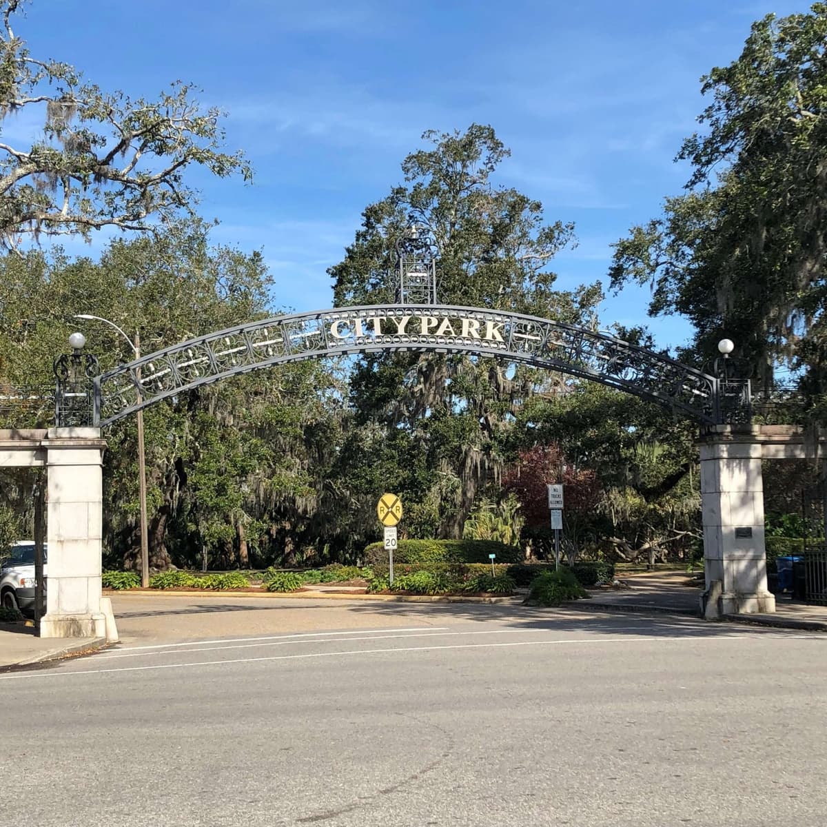
Measured walking routes (OpenStreetMap routing, about 80 m a minute). Add a few minutes in summer.
The museum, the free sculpture garden behind it, the old dueling oak between them, and beignets under the oaks. That's a half-day by itself, and NOMA's galleries are the best air-conditioning in the neighborhood on a July afternoon. Free public tours of the Sculpture Garden run Sundays at 10:30. On select Sundays there's live "Music in the Garden" from 2 to 4.
Turn left at the museum for the long views over Big Lake. There's a Greek-columned pavilion on the bayou, the 800-year-old McDonogh Oak propped on crutches in the Old Grove, and a live oak hung with wind chimes. Rent a swan boat on Big Lake (Wheel Fun Rentals) or a bike to cover more ground. On Sunday mornings from 8 to noon, the Crescent City Farmers Market sets up at the City Putt plaza.
Storyland's giant fairy-tale sculptures have been a New Orleans childhood rite since the 1950s. Next door, Carousel Gardens spins its historic wooden Flying Horses, and the children's museum sits on the edge of Little Lake. These are farther from the stop (13–15 min), so a stroller and an early start help.
Beyond the end of the line · on foot
Step off the car, turn your back on the park, and you're standing at the top of the same Esplanade Avenue that begins at the Old Mint beside the French Quarter. In between lie about two miles that most visitors never see. The avenue follows an old high-ground ridge, the portage path between Bayou St. John and the river, and in the nineteenth century it was the Creole millionaires' row, the downtown answer to St. Charles. Its oaks, mansions and corner cafés were never packaged for tourists. The official tourism board calls it "a hidden treasure."
The first ten minutes are the best: across the bayou to an 1850s cemetery, a 1799 plantation house and a little blue footbridge, then a cluster of the neighborhood's best restaurants. After dinner it's a straight shot home: about 10 minutes by Uber or roughly 15 by bike straight down Esplanade.
Measured walking routes from the Museum of Art stop (OpenStreetMap routing, about 80 m a minute).
Bayou St. John is a slow ribbon of water where locals jog, walk dogs, picnic and paddle. Cross it on Esplanade and you're in one of the oldest corners of the city. Look for the brass 1869 fire hydrant, the city's oldest, at the end of Moss Street. On Wednesdays at 1 p.m. the Louisiana Landmarks Society runs a Pitot House tour plus a one-mile bayou walk that stops briefly in St. Louis No. 3 ($30; reserve by midnight Tuesday).
Where Ponce de Leon Street runs into Esplanade, ten minutes from the car, a handful of restaurants share a few blocks of oak shade. They're why this guide ends here and not at the museum. Cafe Degas is the one we'd cross town for, a French bistro with a covered, open-air dining room. Lola's makes its paella from scratch while you wait with sangria. Liuzza's by the Track is the corner joint with the barbecue-shrimp po-boy. Mind the clocks, because they're neighborhood clocks. Degas is closed Mondays. Liuzza's closes at 8 and is shut on Sundays (unless the Saints are playing). Lola's opens for dinner around 5:30, and its hours vary by listing, so call ahead (504-488-6946).
A straight shot home
About 2 miles straight down Esplanade to the Quarter
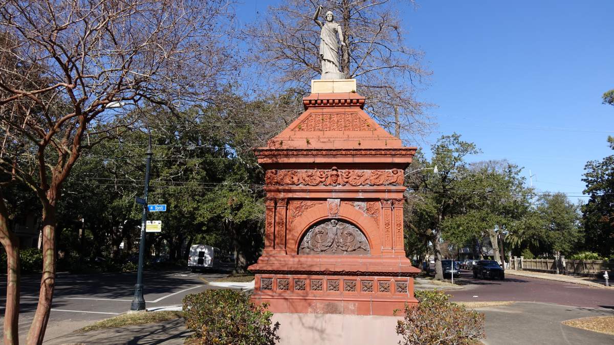
Below the restaurants the avenue runs straight and shady past the Fair Grounds, the terracotta Gayarre Place monument and the house where Edgar Degas stayed with his Creole relatives in 1873, all the way to the Quarter. It's the easiest way to see the most beautiful street most visitors miss. You can do it on foot in cool weather, by bike, or slowly out of an Uber window.

The "third oldest thoroughbred track in the nation," and the home of Jazz Fest each spring. A winter race-day afternoon here is a distinctly local outing; tickets via Ticketmaster.
A triangle of green where Esplanade meets Broad and Crete, given by the Jung family "on the condition that it remain public property" and "graced by an Art Nouveau fence."
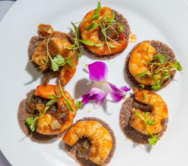
Ethiopian cooking in a new home on Bayou Road, a historically Black street that branches off Esplanade at Gayarre Place. Good for a group dinner on the way home.
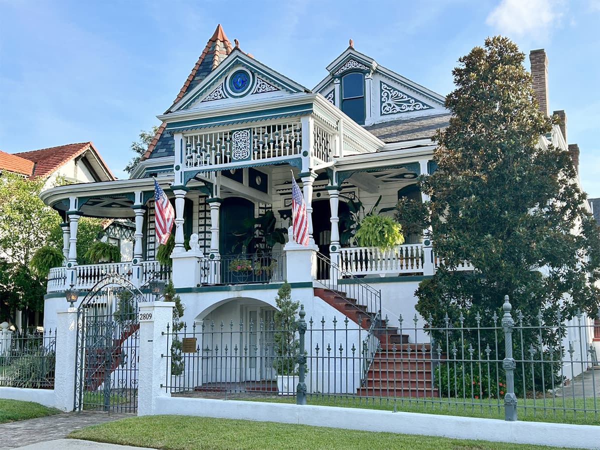
The Creole townhouse where the Impressionist stayed with his Musson relatives for several months in 1873. A guided tour (allow 2.5 hrs) includes a neighborhood walk; you can also sleep here. Call 504-821-5009.
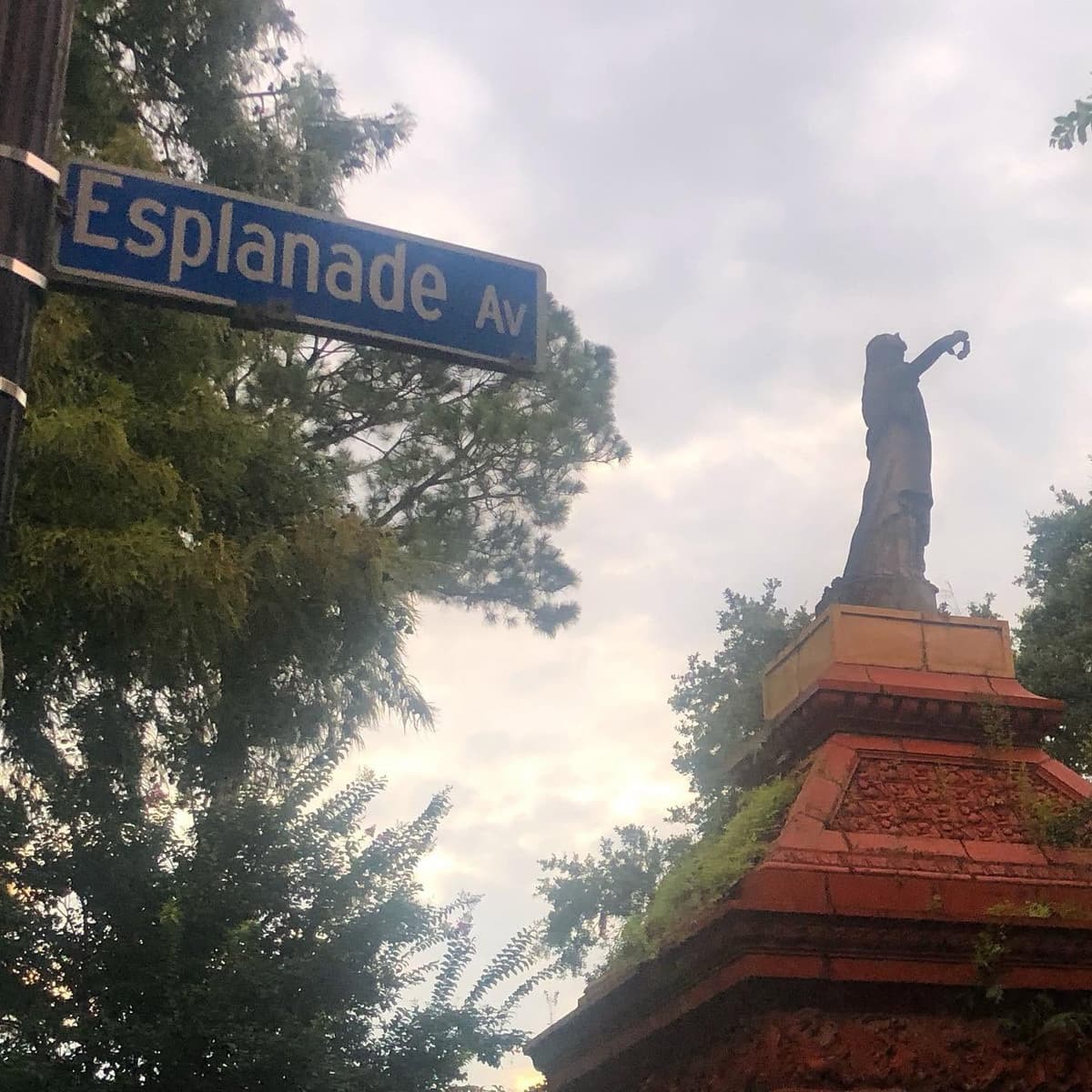
"Esplanade is one of the most beautiful streets in New Orleans, yet barely recognized by visitors as such." Look for the terracotta Gayarre Place monument where Bayou Road crosses, and night herons roosting in the 2300-block oaks.
Order from the restaurant curb; it's about 2 miles straight down Esplanade. Best after dark or in summer.
The flat, straight ride is the best way to see the avenue. Use the Blue Bikes app; there are hubs near City Park and Esplanade. Parts of the lane are unprotected, so ride with care.
A lovely cool-weather walk under the oaks, roughly 2¾ miles from the restaurants to the edge of the Quarter. Don't try it in summer.
A local guide points to the 91 rolling down Esplanade; confirm the route in the Le Pass app.
Walk back to the Museum of Art stop and ride Canal home. It's the slowest option, but the most familiar.

Add-on · the other branch
Route 47
About 30 min from the river · half a day · go in the morning · free to walk in
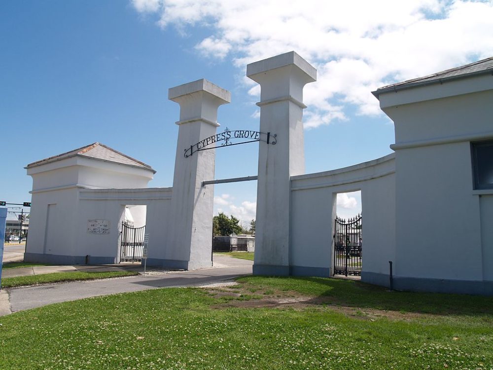
Stay on the car signed Cemeteries and it runs to the very end of Canal Street. It stops in the middle of a dozen old burial grounds, an intersection locals simply call "Canal and the Cemeteries." Greenwood is straight ahead, Cypress Grove is to the left, and the St. Patrick cemeteries are behind you. The French Quarter's famous St. Louis No. 1 is now closed to casual visitors. These are the ones you can still walk into on your own: whitewashed society tombs, cast-iron mausoleums, the firemen's monuments, and the graves of jazz musicians.
To do both branches in one day on a Jazzy Pass, ride a Cemeteries car out first thing (the gates open at 8). Then ride back to Canal at Carrollton and change to a City Park / Museum car for St. Louis No. 3, the bayou and dinner on Esplanade.
EtiquetteThese are working cemeteries with burials every week. Keep voices low, stay on the paths, and keep clear of any funeral. Go in daylight. No bikes or motorized tours. Carry water, because the marble has no shade. Odd Fellows Rest, the triangle at Canal and City Park Ave, has been closed to the public. Skip St. Louis No. 2 on your own; it needs advance permission and a walk through some rough blocks.
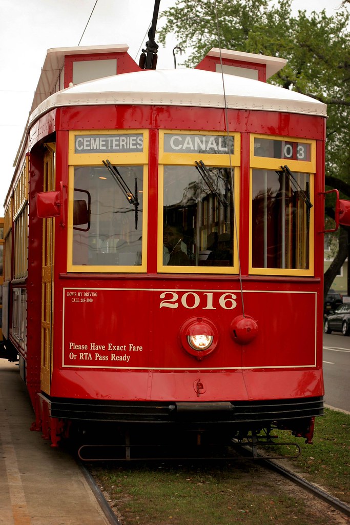
The loop terminal at Canal Blvd and City Park Ave, opened in 2018. Step off and look around: you're surrounded. Buried nearby are victims of the 1853 yellow-fever epidemic and the Irish families of the St. Patrick cemeteries, founded in 1841.
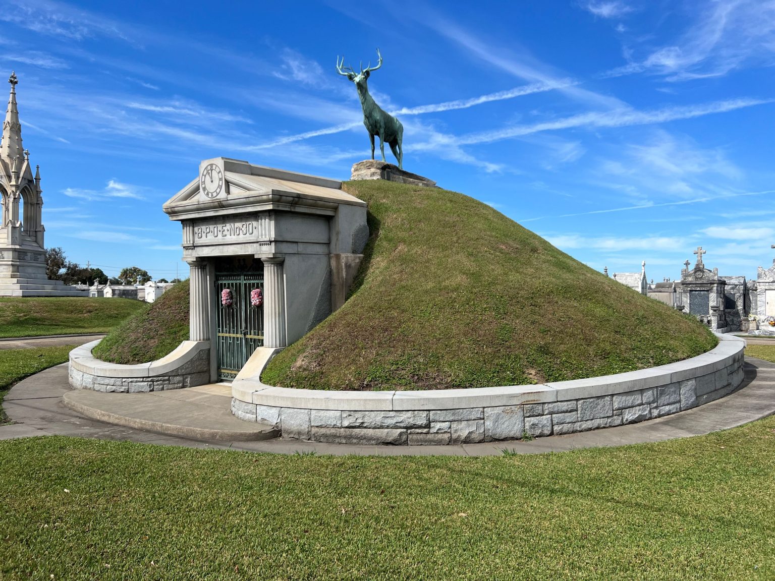
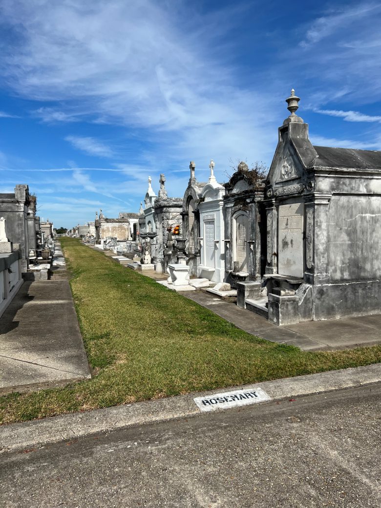
Built by the volunteer firemen's association and still active. By the front gate is the grassy Elks Lodge tumulus with its bronze elk (1912). Inside are the Firemen's Monument of 1884 and rows of cast-iron mausoleums on paths named for plants, like "Rosemary."

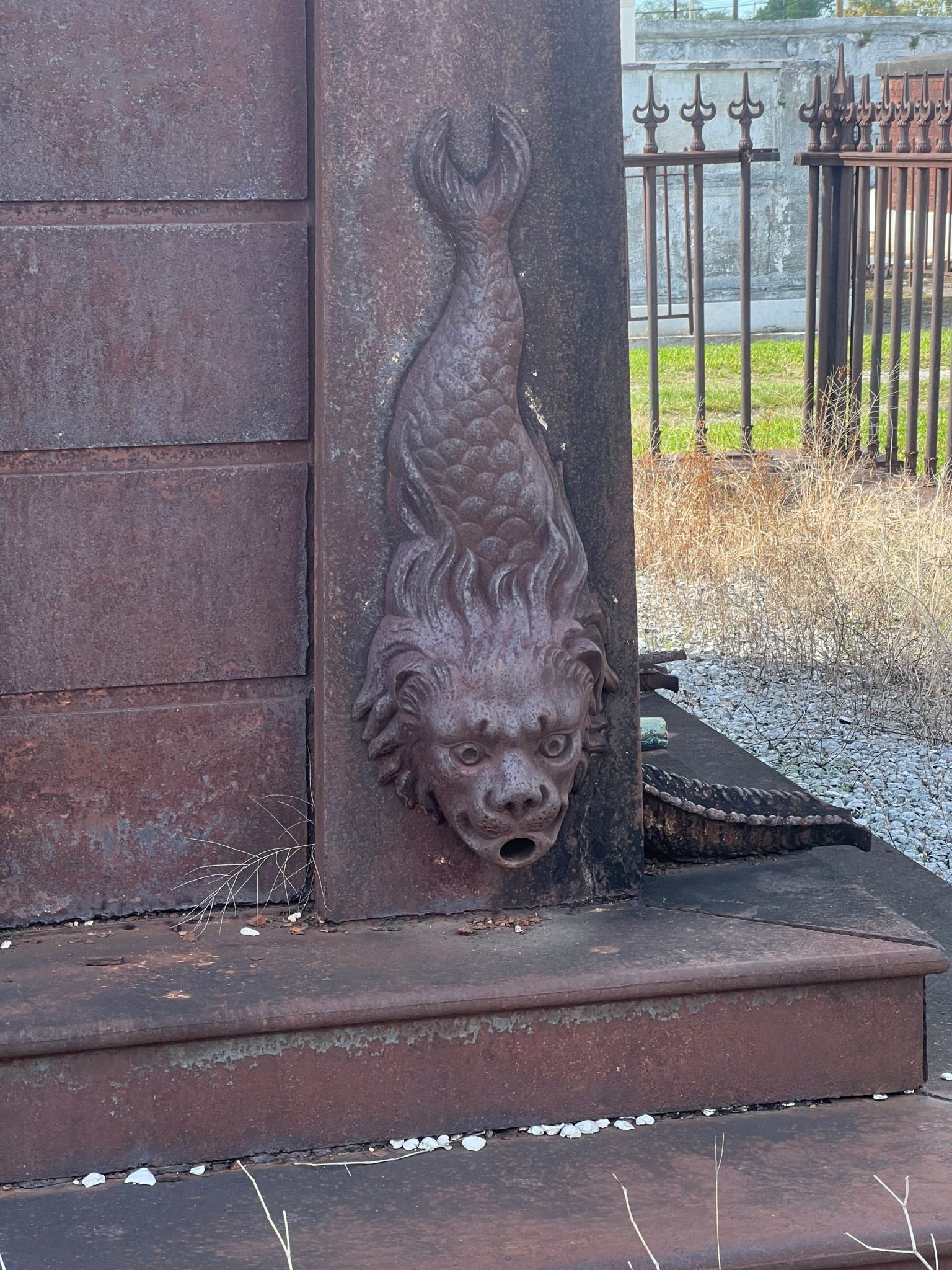
Across City Park Ave from Greenwood, and "the first cemetery built to honor New Orleans volunteer firemen and their families." Look for its Egyptian Revival gate, a fire-engine relief, and the cast-iron Leeds mausoleum with its fish-shaped downspout. Charles Leeds was mayor from 1874 to 1876.
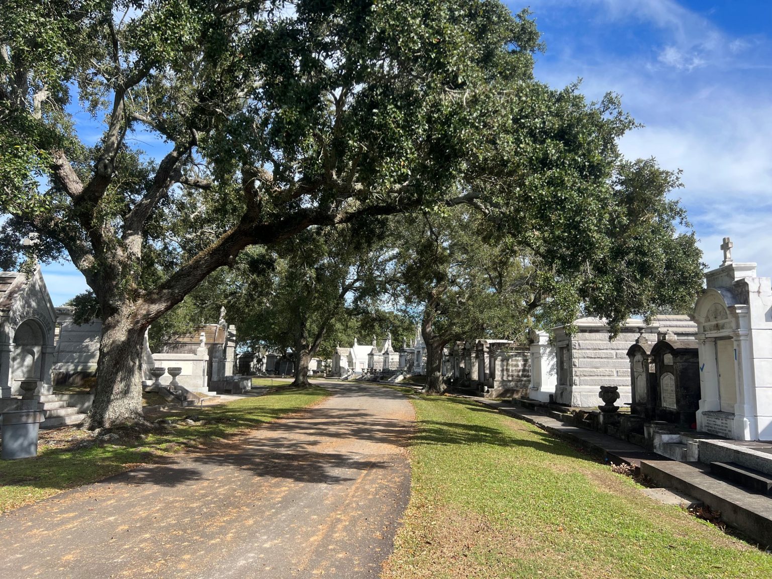
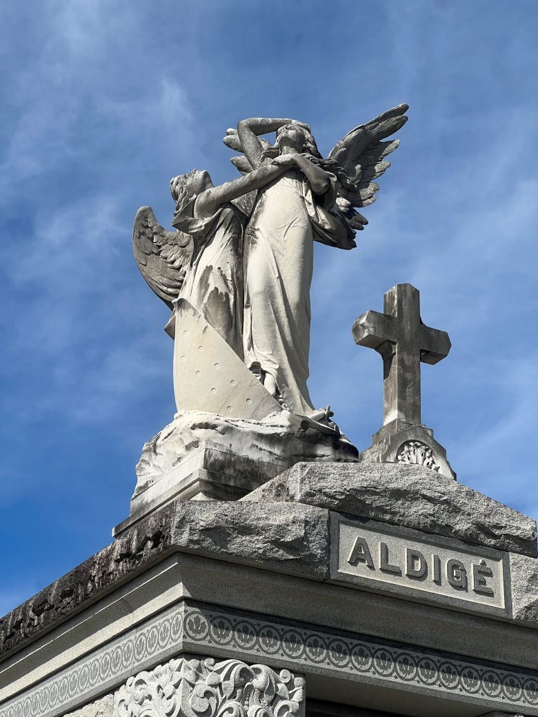
The showpiece: 150 acres laid out in 1872 on an old racetrack, resting place of mayors, governors and Carnival kings. Find the Aldige tomb, an angel and a ship for three women lost when La Bourgogne sank in 1898, and the tomb of bandleader Louis Prima. Walk left on City Park Ave past Greenwood and under the interstate.

The counterweight to all that marble. It's a city potter's field from 1879, beside Delgado Community College, where nearly everyone is buried in the ground under handmade, family-built markers. A monument here honors Buddy Bolden, the cornetist often called the father of jazz. Families still tend these graves, so look and photograph quietly. The ground floods after heavy rain.


Pins for Metairie Cemetery and Holt are approximate (park edge and street address). Cemetery hours vary by source, so confirm before a special trip.
Stay
Most visitors stay downtown, and that's fine: anywhere along Canal puts the red car at your door. The real choice is whether to sleep on the busy end of the line or out on the quiet one.
| Best for | On your doorstep | Getting to Mid-City | The catch | |
|---|---|---|---|---|
| French Quarter, Canal edge | First-timers who want to walk to everything | Bourbon, Jackson Square, the Carousel Bar, Antoine's and Arnaud's | Canal at Bourbon or Royal, 30–45 min to the park | Noise and crowds at night; highest rates |
| CBD on Canal | Big-hotel comfort, quieter nights | Canal Street, the Riverwalk, the ferry, an easy walk to the Warehouse District | Several hotels have a stop at the door | Less historic character; fewer places to eat nearby |
| Mid-City & Esplanade | Repeat visitors, Jazz Fest, City Park days | City Park, NOMA, Bayou St. John, the Esplanade restaurants | You're already there; the Quarter is a 30–45 min ride or 10-min Uber | Little nightlife; Esplanade inns need a walk or ride to the car |
Sample rates were pulled for Dec 23–24, 2026, a holiday week, so treat them as a rough guide. Mardi Gras and Jazz Fest weeks run far higher.
Few hotels, mostly historic inns and B&Bs. You can also sleep in the Degas House on Esplanade (see the Esplanade section).
Every place in this guide
The solid red line is the City Park / Museum car (Route 48), drawn from OpenStreetMap. The dashed grey line is the Cemeteries branch (Route 47) to the end of Canal. The dashed terracotta line is the ride home down Esplanade to the French Quarter. Open the split view with "◂ Map" in the top bar to follow along as you read.
Sources & credits
Every fact here traces to the sources below. Photos are hotlinked from the pages listed and remain the property of their photographers and publishers. Tap any photo to see its credit and source in the viewer. Walking minutes were measured on OpenStreetMap foot routing between geocoded addresses and the streetcar stops in OpenStreetMap's Route 48 and 47 data. Hours, prices and dates were checked in October 2026 and change often, especially Pandora's season, cemetery gates and streetcar service around Carnival. Confirm before you go.
Booking.com and Agoda listings for sample rates and photos.
Map data © OpenStreetMap contributors (ODbL); tiles by OpenFreeMap. Geocoding: US Census Geocoder and Photon (OpenStreetMap data). Walking, biking and driving times: FOSSGIS OSRM routing. Climate: NOAA 1991–2020 U.S. climate normals (approximate, rounded).
Safe travels!